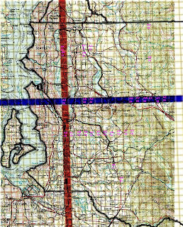
Puget sound lidar consortium shares King County lidar data as "township" rectangles (terminology is weak here). In any case, the whole county is described by coordinates such as ak23 and bc20.
A rather non-helping image is shared by King County GIS services which ends up helping me to guess that I need something around ak20, downloading that and then counting from that one, which one I really need. Hopefully the guess was close enough.
So, to solve this ridiculous issue, I did the following - I put topo maps using global mapper on top of these township rectangles. No more guessing!
It is not the best quality one, but certainly very helpful, so I share the result.
Now we know that ax35 is Drunken Charlie lake, an32/an31 - willows fjords, ar11 - sawyer lake.
Now more guessing!

No comments:
Post a Comment