
Wednesday, March 21, 2012
Dungeness spit
I have been playing around on-line data from Dungeness recreation area. This is what I have accumulated it into.
 They say it is a 230 acre park, so half of Bridle trails (460 acres). Just in case someone is out for vacation there, it might be worthwhile looking into this map.
Vegetation is approximate at this point.
Roads and tax parcel information from Clallam county GIS.
Contours are 2.5 meter ones from, current scale is 1:7500.
The area is interesting because it has different vegetation and is open to general public off-trail at least in the southern part of it - hunting is allowed there during hunting season.
They say it is a 230 acre park, so half of Bridle trails (460 acres). Just in case someone is out for vacation there, it might be worthwhile looking into this map.
Vegetation is approximate at this point.
Roads and tax parcel information from Clallam county GIS.
Contours are 2.5 meter ones from, current scale is 1:7500.
The area is interesting because it has different vegetation and is open to general public off-trail at least in the southern part of it - hunting is allowed there during hunting season.
Sunday, March 18, 2012
Final results to Willows Fjords 2012
Willows Fjords course is closed.
These are now final results of WF2012:
Course 2:
Jan/Ing 1:46
Rick/Kean 1:50
Ing/Susan/Debbie 2:28
Route gadget.
These are now final results of WF2012:
Course 2:
Jan/Ing 1:46
Rick/Kean 1:50
Ing/Susan/Debbie 2:28
Route gadget.
Sunday, March 4, 2012
Willows Fjords
Willows Fjords challenge is up:
For potential parking, start and finish locations, see here.
For general description of the trails, see here (Evergreen MTB).
Please respect no trespassing signs and play responsibly.
The map you will be running on:

I hope to get at least 2 runners, so that there is some competition.
For map with checkpoints, please email me.
Friday, March 2, 2012
Lidar points as township rectangles
Puget sound lidar consortium shares King County lidar data as "township" rectangles (terminology is weak here). In any case, the whole county is described by coordinates such as ak23 and bc20.
A rather non-helping image is shared by King County GIS services which ends up helping me to guess that I need something around ak20, downloading that and then counting from that one, which one I really need. Hopefully the guess was close enough.
So, to solve this ridiculous issue, I did the following - I put topo maps using global mapper on top of these township rectangles. No more guessing!
It is not the best quality one, but certainly very helpful, so I share the result.
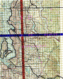 Now we know that ax35 is Drunken Charlie lake, an32/an31 - willows fjords, ar11 - sawyer lake.
Now more guessing!
A rather non-helping image is shared by King County GIS services which ends up helping me to guess that I need something around ak20, downloading that and then counting from that one, which one I really need. Hopefully the guess was close enough.
So, to solve this ridiculous issue, I did the following - I put topo maps using global mapper on top of these township rectangles. No more guessing!
It is not the best quality one, but certainly very helpful, so I share the result.

Now more guessing!
Tuesday, February 14, 2012
Two point five maps in works
FYI, there are 2.5 maps in works.
Crestwoods park has been looked at, drawn and found almost good to go. Nikolay Nachev, team USA orienteer is test running a course on it this week. The date of the race most likely will be some late April or so.
Second map - Willows Fjords has been run in and a base map is being made. Two great resources have been found for usage with it:
- Switchbacks.com, which provides Garmin GPS compatible map files of GPS-ed trails of Western Washington. It is not the most useful in terms of GPS quality, bvut for overall understanding of what is happening around - it is just great.
- Redmond GIS - building bases, roads, etc, - all for download.
Saturday, January 14, 2012
First event results
Murray&Peteris: run time around 3:20. CPs reached - 1,2,3,4,5,6,7. At 7 the wet snow became very, very cold and we bailed out.
On the run: it took as 20 minutes or so to get to the start, CP1 - 30 minutes. CP20 - 30 minutes, CP3 - 15 minutes and so on.
This post will be updated if more runners attempt it or more data comes in (gpx files).
On the other hand, I made some updates to the map. Very approximate, very home-brew.
Here it is:

Friday, January 13, 2012
Homebrew O', first event

Hello. The image is an image of partial homebrew lake charlie map. No small features, just lidar contours, some roads. Most of data is from King county GIS warehouse.
The meaning of this exercise is mostly contours.
Take a look at this google map. Point A is where you leave your cars, point B is the start.
To print out the map, click on it, it should open it in full screen, save it as a jpeg file and print it at 600 dpi. It should yield you 1:15000 map. The horizontal distance between the magnetic lines is 1km (I believe).
If you happen to do this training event, please post your results and what you saw in the comments.
Note: map is updated, I had disabled every 5th contour line.
Subscribe to:
Posts (Atom)